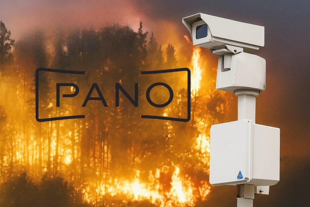
Last week, Pano AI, a wildfire‑detection startup based in San Francisco, closed a $44 million Series B round, led by Giant Ventures and joined by Liberty Mutual Strategic Ventures, Tokio Marine Future Fund, Initialized Capital, Salesforce Ventures, and others. This fresh infusion brings Pano’s total funding to $89 million, empowering the company to scale its panoramic‑camera smoke detection system across the U.S., Australia, and now, Canada.
Why This Funding Matters to World?
Growing Wildfire Threat — and a Big Data Problem
Wildfire frequency and intensity are surging globally. In the U.S., 2024 saw nearly 65,000 wildfires, up from around 56,500 in 2023, burning 8.9 million acres—a stark increase from the 2.7 million acres consumed in 2023. With wildfire seasons becoming longer and unpredictable, even traditional fire‑lookout systems or satellite reporting can be too slow to stop devastation.
A Strategic Investor Mix
The Series B includes a balanced mix of venture capital, insurance, and corporate investors. The participation of finance giants like Tokio Marine reflects a strategic trend: insurers are backing climate‑tech tools that help mitigate natural hazard risk. Market leaders like Salesforce and Initialized continue their support, showing that Pano’s solution blends commercial viability with public‑sector impact.
How Pano AI’s Tech Works?
360° Panoramic Cameras + AI Algorithms
Pano deploys two rotating 6‑megapixel cameras with 30× optical zoom atop vantage points—covering up to 20 km in radius. These cameras generate panoramic imagery every minute, fed into AI trained on over 2 billion images, enabling detection even in varied conditions—fog, haze, snow, or night.
AI + Human Analysts = Fewer False Alerts
What separates Pano is their hybrid approach. After the AI flags potential smoke or heat, a team of human analysts verifies the signal—filtering out farm equipment, dust, or fireworks. This human-in-the-loop method reduces false positives before dispatching alerts to first responders.
Triangulation & Swift Alerts
By combining detections from multiple cameras and overlaying satellite or weather data, Pano delivers GPS coordinates of emerging fires within minutes—often faster than calls to 911. The result? Authorities can deploy resources early and contain fires that might otherwise evolve into major disasters.
Real-Life Impact
On June 16, 2024, during Red Flag conditions in Douglas County, Colorado, lightning struck remote Bennett Mountain. Within minutes, Pano detected smoke, confirmed it via human review, and relayed precise location data.
- A 40-person ground crew faced a two-hour hike.
- Meanwhile, helicopters dropped 18,000 gallons of water over five hours.
- The fire was contained to just three acres, protecting a watershed serving over 1 million people.
Douglas County’s Emergency Manager, Mike Alexander, said:
“Pano AI gave us early confirmation and precise coordinates … that critical lead time helped us contain the Bear Creek Fire before it became a more destructive event.”
Global Footprint & Client Ecosystem
- Coverage: 30 million acres across 10 U.S. states, 5 Australian states, and British Columbia, Canada.
- Agencies: Over 250 first-responder organizations.
- Utilities: Trusted by 15 major power suppliers, including Xcel Energy, Arizona Public Service, and Portland General Electric.
In Australia, forestry manager Forico deployed Pano cameras to triangulate bushfire smoke—protecting over 2 million hectares. Forico’s GM emphasized the importance of “rapid and precise fire insights” to safeguard both forestry and regional communities.
Expert Opinion
- Cameron McLain, Giant Ventures
“Pano AI is creating a new layer of resilience that will massively reduce the impact of increasingly frequent fire events.”
- Masashi Namatame, Tokio Marine
“This is now a global challenge … Pano is creating the early detection infrastructure needed in wildfire‑exposed regions.”
- Sonia Kastner, CEO of Pano AI
“The time to adapt to extreme weather events is now.”
What’s Pano AI Plan?
With new Series B capital, Pano plans to:
- Expand geographic reach, increasing camera networks, including deeper into Canada and U.S. wildfire zones.
- Enhance AI accuracy, using a growing dataset that spans terrains, weather, and night‑time conditions.
- Build public‑sector partnerships, investing in government relations to support easier procurement and deployment.
Pano CEO Kastner notes: “We’ve invested in a government affairs team… replicating what works for defense tech in the wildfire space”.
Why This Matters for Communities & Climate Resilience?
- Protecting lives and property: Early detection enables quicker firefighting response—reducing disaster scale.
- Safeguarding infrastructure: Utilities and water systems benefit from timely warnings to de-energize lines or secure resources.
- Lowering risk costs: For insurers like Tokio Marine, early detection translates to reduced damage payouts.
- Scaling climate tech: Pano exemplifies innovation when private enterprise and public safety align.
Conclusion
Pano AI’s panoramic, AI‑powered system—backed by human oversight—is more than just tech. It’s real‑time resilience in the era of climate crisis. By catching smoke fast, triangulating its location, and alerting responders, Pano turns minutes into lifelines. Their expanding footprint across wildfire hotspots proves that smart funding, smart tech, and human expertise can combine to protect communities—and reshape how we fight fire in a changing world.
